|
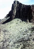
OIBs & Continental Alkali-Basalt-Basinites There are not a great many alkali basalt associations within the continents, most tend to be on the oceanic islands or at continental margins, especially along block faults or incipient spreading centres such as the E. African Rift. The Cameroon Line South-east of Nigeria in the Gulf of Benin are a series of active volcanic islands, Pagalu, Sao Thome, Principe, Fernado Poo, and inland Mt Cameroon, (13,500ft) lying along an apparent fault that crosses the continental margin.. Fitton & Dunlop (1985, EPSL 72) claim there is no change in composition on either side of the continental-oceanic conjunction. |__| Pagalu. Europe Small centres occur in Europe. The Pliocene-Quaternary Catalonian Volcanics in NE Spain (Coy-Yll, Gunn & Travaria, 1974, Acta.Geol.Hispanica) are quite ordinary basanites, but the jumillites and verites of southern Spain, (Borley,1967.Min.Mag.36) are variable but highly potassic with up to 6% K2O at 50-60% SiO2. Basanites of West Germany in the Laachersee area (Schminke et al...) are again unremarkable as are small areas of alkali basalt in the south of France. The East African Rift, (Western branch) The western rift is a great graben which extends for 750 miles from L. Albert to L Tanganyika and beyond through L. Nyasa.
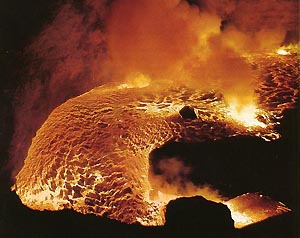
About 100 miles west of Lake Victoria within the main Rift Zone are three areas of most remarkable potassic volcanics. North of Lake Edward is the Ruwenzori Range and the Toro Ankole province. A little further south between L. Edward and Lake Kivu is an area variously described as the Bufumbira, the Virunga or Birunga or Lake Kivu province. It includes several active and dormant cones, Nyamuragira, Nyiragongo, (11,380 ft), Karisimbi, (14,850ft), Mikeno (14,700ft), Visoki and Muhavura. Nyiragongo especially, has been subject to much attention because of a pit crater within a
Haroun Tazieff, the well-known volcanologist, has made an especial study of this mountain. The rocks of the region are variously described as potassic basanites, leucite basalts or leucite nepheline melilite basalts. Stress is laid on their variability in different centres. The nepheline is usually potassic and may be kalsilite. Oddly, the data do not show any great differences between centres nor are most rocks abnormally potassic (see MORB normalised diagram below). In fact the basanites appear similar to those of Tristan or Gough Islands. However, some highly fractionated lavas are very potassic with 3-5% K2O, very low silica (35-40%) and oddly high CaO at low Mg. Melilite is usually found only in high Ca rocks. Whether these oddities are due to ingestion and desilication of limestone (but no blocks of wollastonite (CaSiO3) are reported), or whether as the leucite-nepheline tends to aggregate in what Tazieff calls "nests" and the very high K is due to poor sampling it is not possible to tell.
The East Branch Of The E.A.R.S. (East African Rift System) A rift system begins at the Afar Triple Point in Ethiopia where the spreading centres of the Red Sea, the Gulf of Aden and the African rift join.
Rather than E-type MORBs which might be expected in an incipient spreading centre, the lavas are seemingly all alkaline, mainly potassic in the western branch and mainly sodic in the eastern.
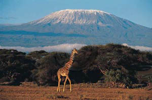
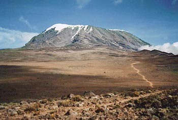
Kerimasi, an extinct carbonatite cone lies immediately to the south east. Four other carbonatite cones are known in the general area of northern Tanzania, as well as Kisingiri in west central Kenya (Peterson, 1989) Oddly, there seems to be no recent data for even such a well known centre as Kilimanjaro. The Navaisa perakaline commendites reported under "Rhyolites-Trachytes-Phonolites" lie about 30mi NW of Nairobi. A group from Penn State University headed by Dr Tanya Furman is working on the EARS and have obligingly allowed us to see all the data. While some series from near the Afar Triangle are transitional the rest as far south as southern Lake Tanganyika, are alkaline, sometimes highly so. Zr/Nb, La/Lu and isotopes overlap with oceanic OIBs. Small volume flows of differing composition and little fractionation seem to be typical.No characteristics of a spreading centre can be seen. Has the the bifurcating spreading of the Read Sea and the Horn of Africa resulted in a series of south propagating tensional faults, but without true spreading? The EARS is more than a little puzzling. Russia China In north-eastern China is a large field of basanites, AOB's and tephrite, the Holocene Jingpohu series, Zhang et al, 2002, Geoch.Jour. 36, 133-153. Carbon ages give 2470 - 3490 yrs. The series are quite potassic and minor leucite is found in the tephrites.
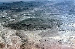
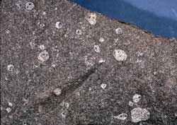
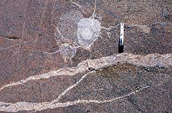
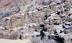
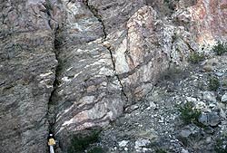
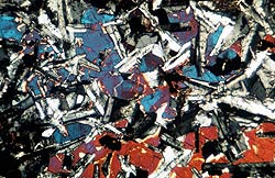
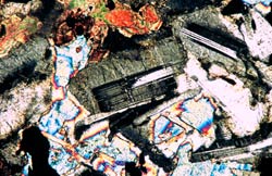
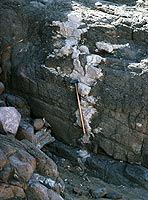
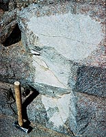
Once again we see liitle diffence between continental and oceanic AOB's. Canada The Monteregian Hills A line of the eroded bases of a series of Lower Tertiary-Cretaceous alkaline centres extend along a line east of the city of Montreal. Mount Royal itself is the best known. The core of the mountain is a black-coarse-grained cumulate of titanaugite, (Montrealite). The standard rock, the Mount Royal Gabbro (MRG) comes from this. There also a wide range of related intrusives, inchscale layered steeply-dipping leucogabbros, syenites, microsyenites and lamprophyres often with coarse kaersutite. No lava flows remain. At Oka to the west are carbonatites with a high REE content. |__| The Mount Royal "Gabbro". USA Alkali Basalts – Syenites of West Texas The Terlingua region of West Texas is located in the Big Bend of the Rio Grande (or Rio Brava) between the Chisos Mountains and the Mexican border. A small basaltic province of Early Tertiary age is intruded into and overlies shallow water Cretaceous sediments. The lavas are mainly of alkali basalt (the Alamo Creek Basalts) and the intrusions are of syenogabbro and syenodiorite. This area has been a special project for many years of Dr Max Carman of the University of Houston and his students while I also assisted at times. The rocks are of special interest as the sills show late stage segregations of ocelli, veins, bands, layers, cylinders etc of a micro-syenitic (or trachy-phonolite) residue, (see Carman, Cameron, Cameron and Gunn, 1969). It demonstrates in a small way the means by which large syenite intrusions and trachyte flows originate. These features are best seen in the 400ft thick Rattlesnake Mtn Sill. The main rock is of clinopyroxene and plagioclase of about An 50-60. The syenitic layers have biotite, opaques, sodic plagioclase and alkali feldspar. Carman recognises an earlier plagioclase –rich syenite followed by a plagioclase-poor syenite. Click to contact the author: Copyright © 1998-2003 Dr B.M.Gunn |
